
Woodhouse Ridge in the Past
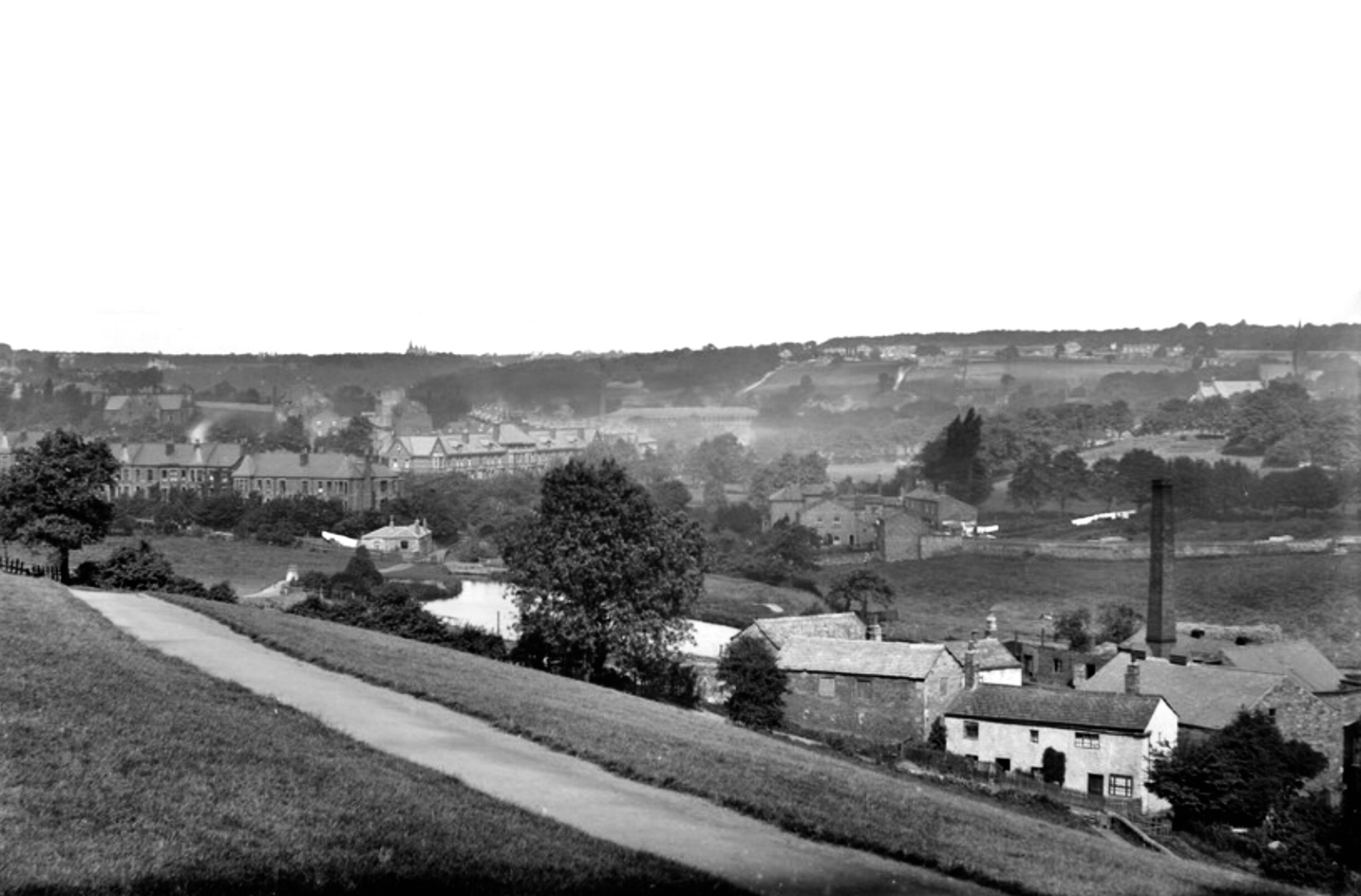
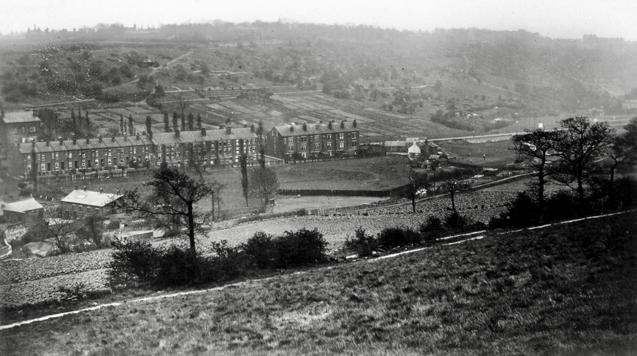
![Bottom Meadows, Woodhouse Ridge, from Woodland Dye Works [demolished], 1888](https://images.squarespace-cdn.com/content/v1/58c140216b8f5b630c91e446/1552905321233-3TWCK837JE5J7SNJV8Z1/IMG_8037.jpg)
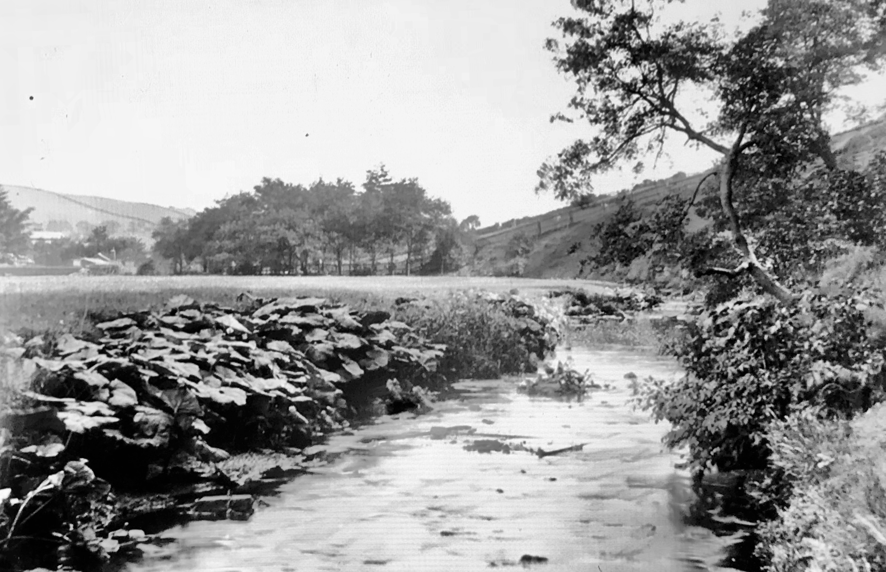
![Groves Mill [demolished], from Batty’s Wood, 1888](https://images.squarespace-cdn.com/content/v1/58c140216b8f5b630c91e446/1552905312137-U4W922JHJOCQGSB1BK2E/IMG_4071.jpg)
![Woodland Dye Works [demolished], Meanwood Valley, circa 1890](https://images.squarespace-cdn.com/content/v1/58c140216b8f5b630c91e446/1552905696715-C14NBDCQMD64MZDR3QL7/IMG_2358.jpg)
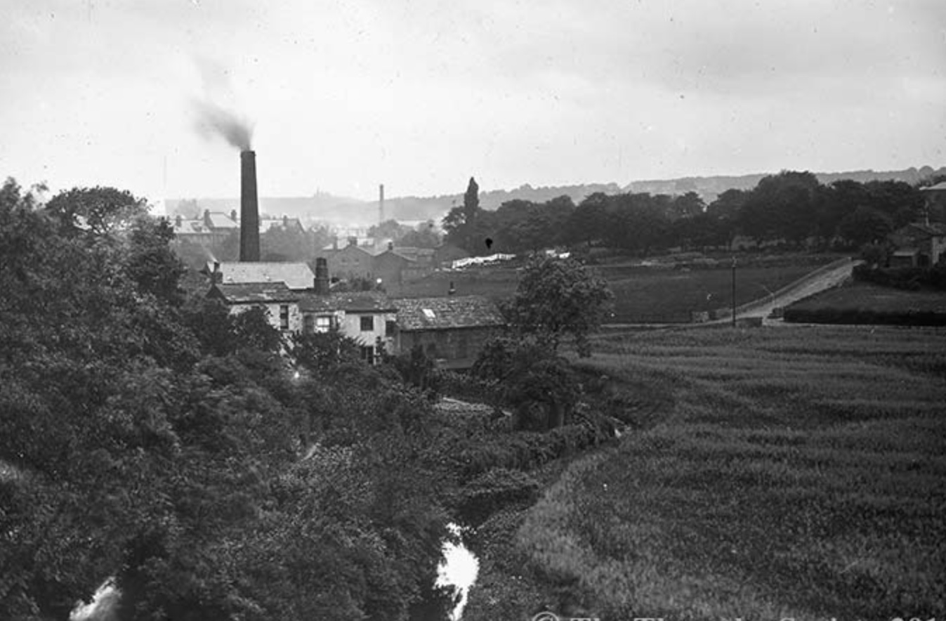
![Woodland Dye Works [demolished], from Woodhouse Ridge, circa 1890](https://images.squarespace-cdn.com/content/v1/58c140216b8f5b630c91e446/1552905702261-ZGCDWI2R1SEMLUJJV7NU/IMG_4918.jpg)
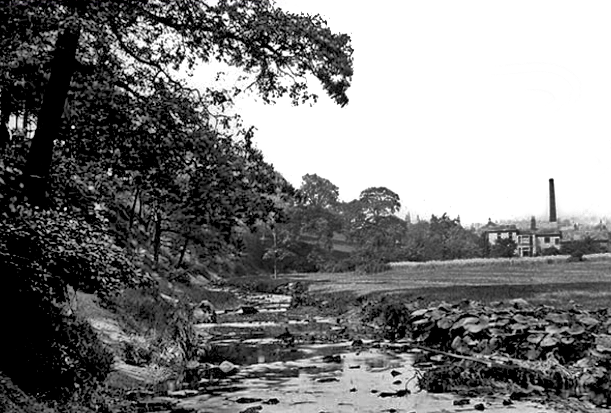
![Mill Pond, Woodland Dye Works [demolished], 1910](https://images.squarespace-cdn.com/content/v1/58c140216b8f5b630c91e446/1552913243512-1N5PGLW3WJTM59OAP62Z/2003102_7607668.jpg)
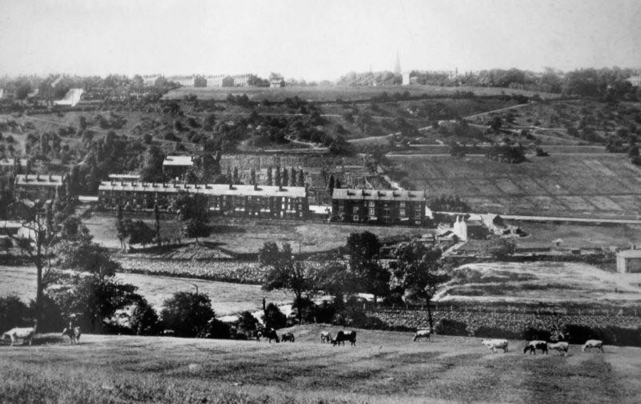
![Groves Mill and Pond [demolished], circa 1890](https://images.squarespace-cdn.com/content/v1/58c140216b8f5b630c91e446/1552905715502-POT22I2BEZ3NIBKIYAB3/IMG_8994.jpg)
![Woodland Dye Works [demolished], undated](https://images.squarespace-cdn.com/content/v1/58c140216b8f5b630c91e446/1552913237132-ZSIF3SSKHWMUCEH2T22L/IMG_2378.jpg)
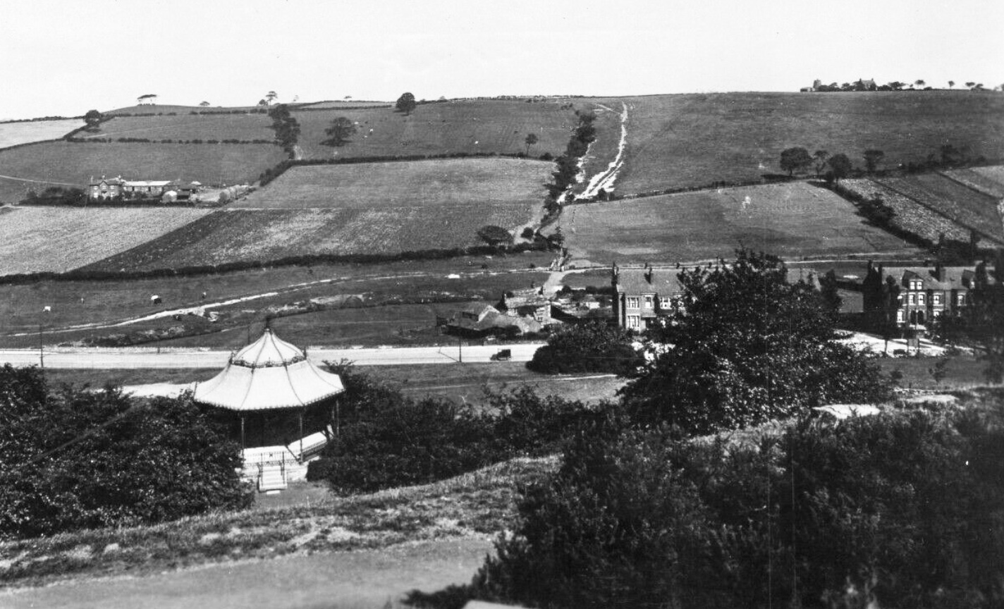
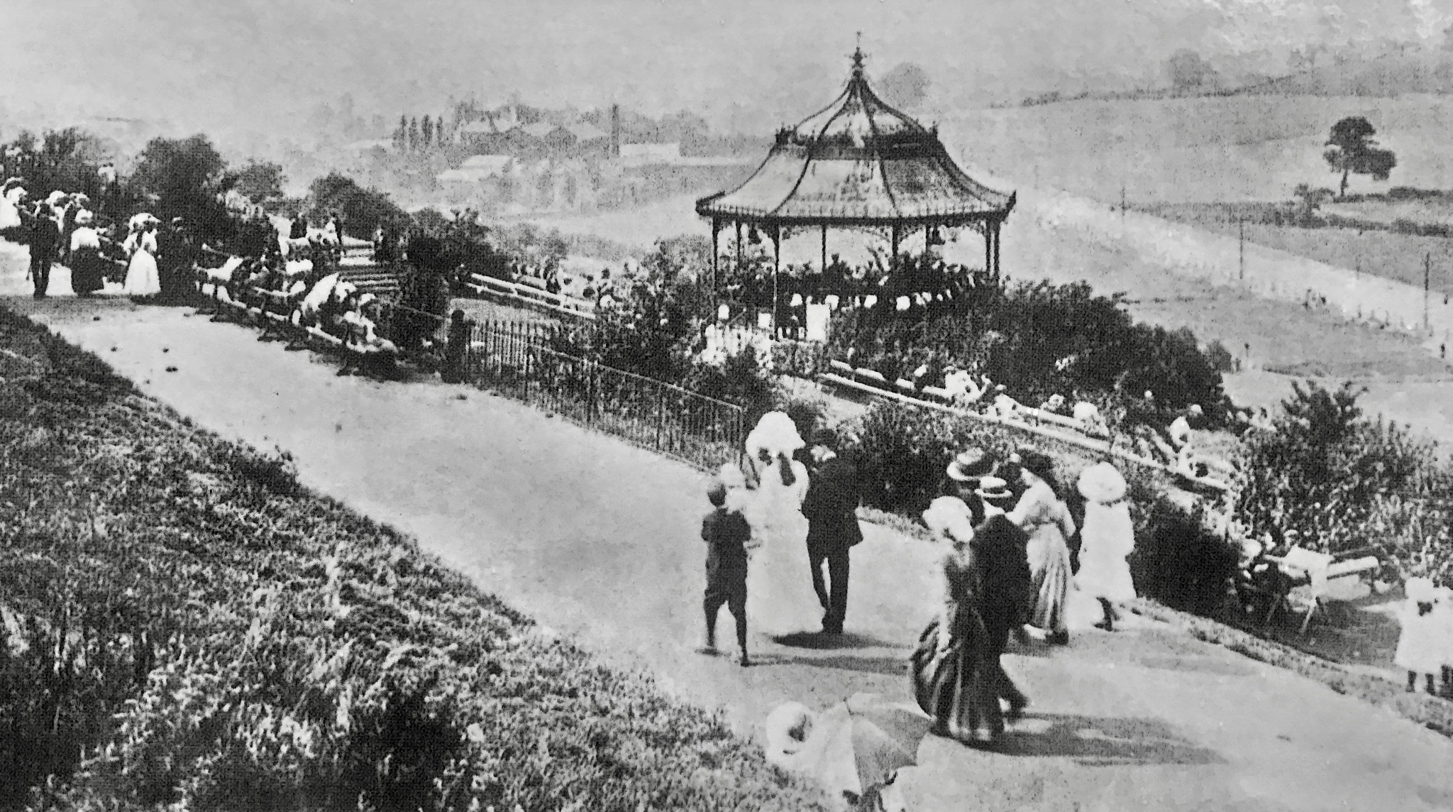
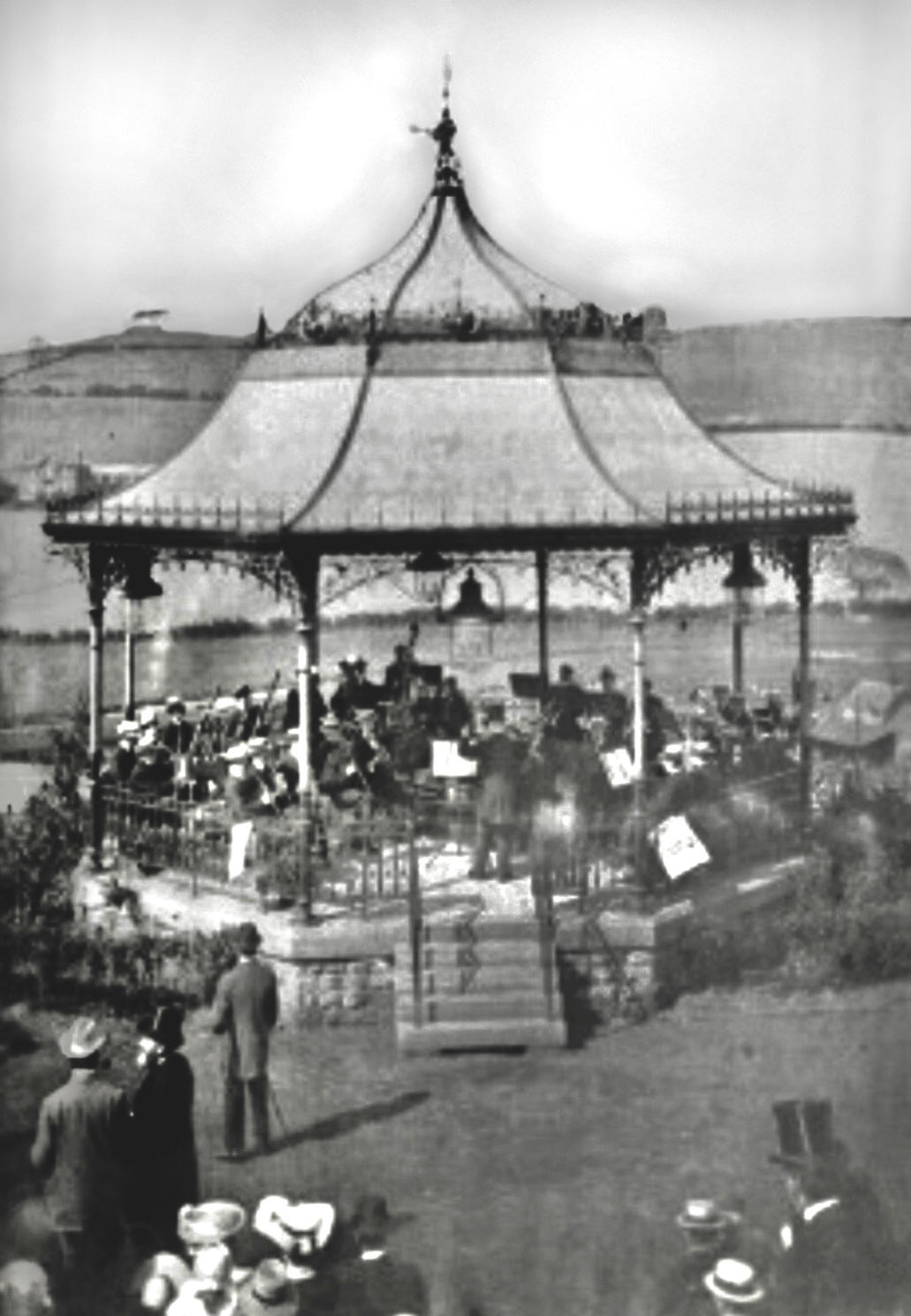
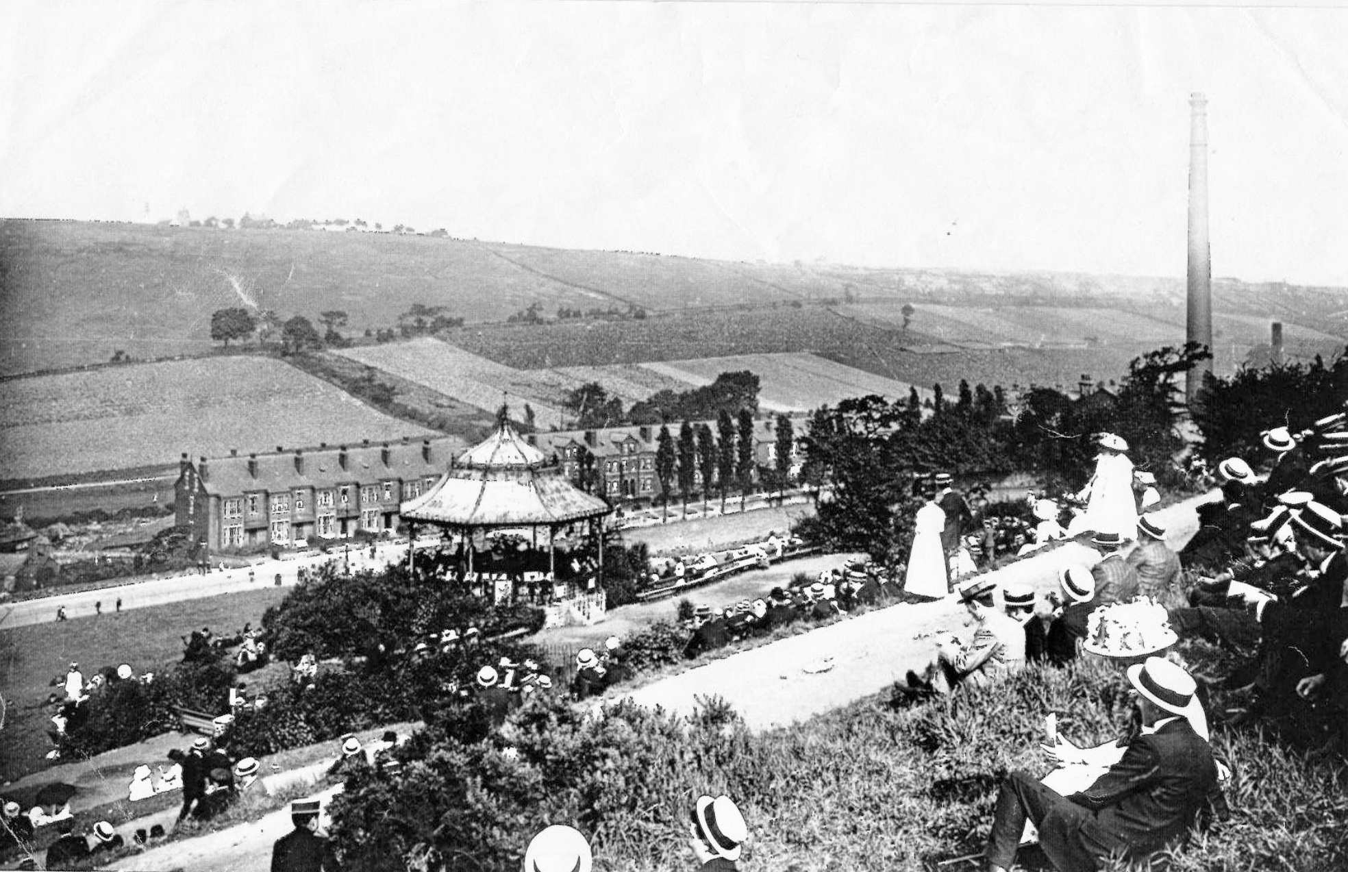
![Woodhouse Ridge, with Chinese Pavilion [demolished], undated](https://images.squarespace-cdn.com/content/v1/58c140216b8f5b630c91e446/1552912801847-C99ACAXX9K53IXZ43D0Q/IMG_7922.jpg)
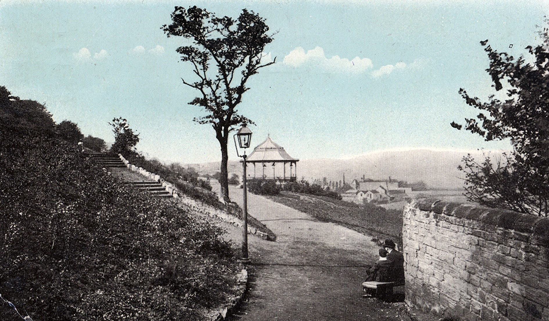
![Woodhouse Ridge, with Chinese Pavilion [demolished], undated](https://images.squarespace-cdn.com/content/v1/58c140216b8f5b630c91e446/1552912912073-5JX2KXB4ETU7QLDPJJVF/IMG_8443.jpg)
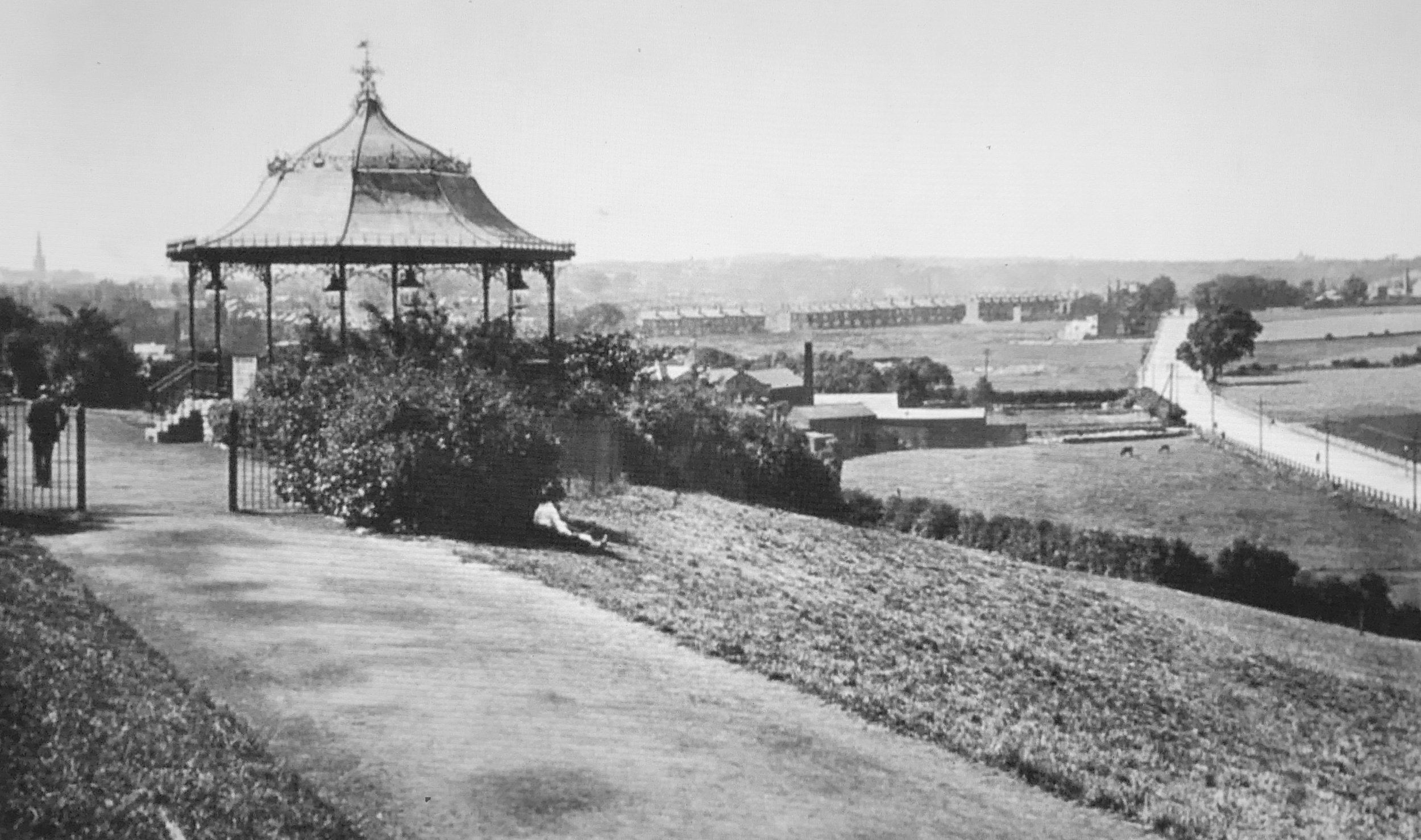
![Woodhouse Ridge, with Chinese Pavilion [demolished], undated](https://images.squarespace-cdn.com/content/v1/58c140216b8f5b630c91e446/1552912906935-YHGS3ALKJRSP4YL22KNG/IMG_3159.jpg)
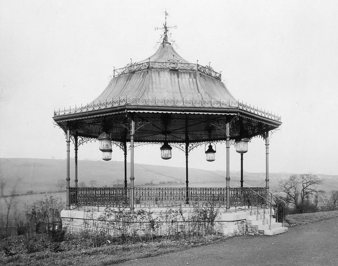
![Warburton Memorial Shelter/Chinese Pavilion [demolished], Woodhouse Ridge, circa 1913](https://images.squarespace-cdn.com/content/v1/58c140216b8f5b630c91e446/1552913012559-SGS9BN612XXXLB8P79ZF/IMG_3870.jpg)
![Warburton Memorial Shelter/Chinese Pavilion [demolished], Woodhouse Ridge, undated](https://images.squarespace-cdn.com/content/v1/58c140216b8f5b630c91e446/1552913008487-WVB6LL5PRHF4NFC53W4R/IMG_3371.jpg)
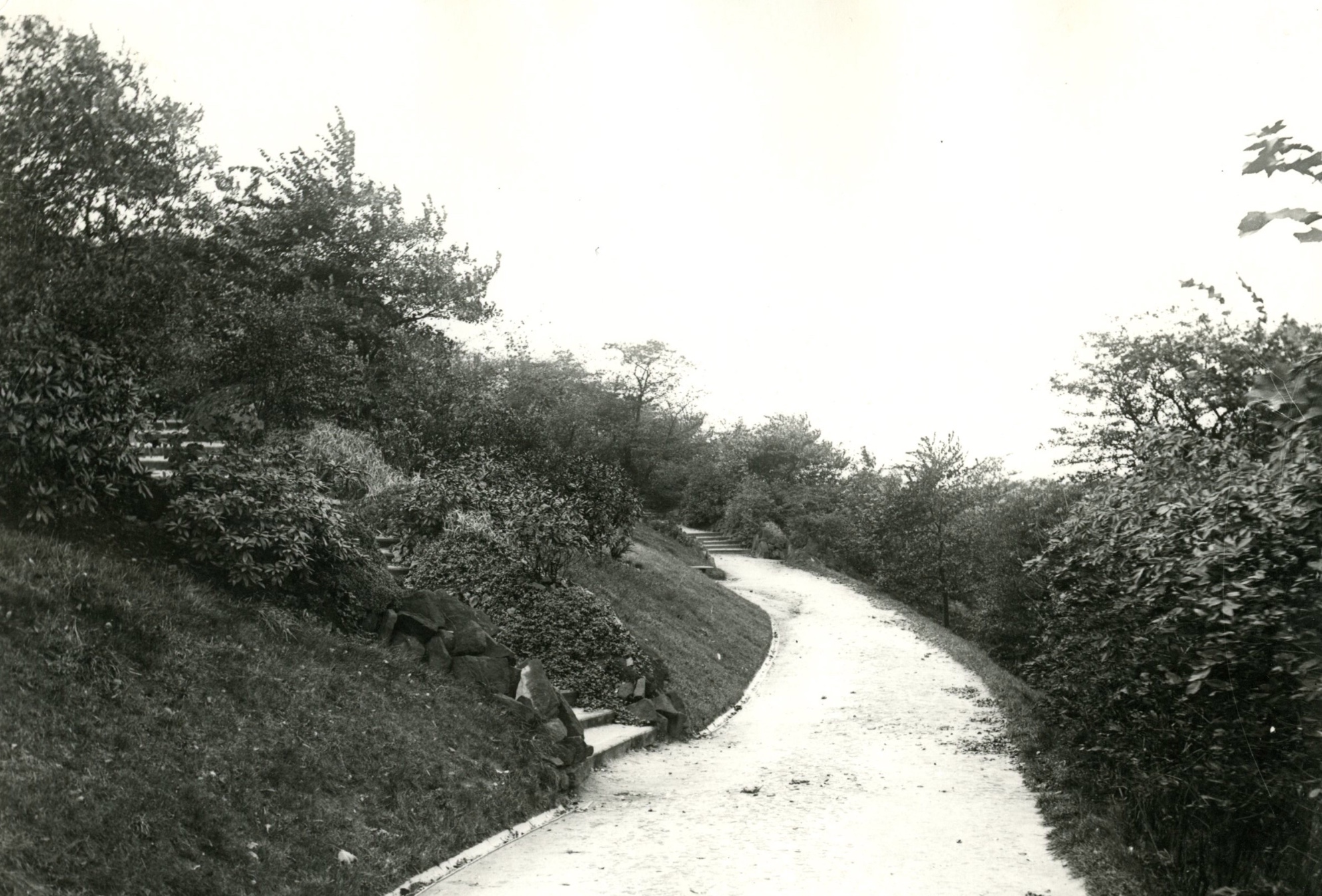
![Woodhouse Ridge, with Belvedere [demolished], Middle Path, 1904](https://images.squarespace-cdn.com/content/v1/58c140216b8f5b630c91e446/1552913021458-CPZ7M8K5CUIVL2M91OK9/IMG_5884.jpg)
![Belvedere [demolished], Middle Path, Woodhouse Ridge, 1904](https://images.squarespace-cdn.com/content/v1/58c140216b8f5b630c91e446/1552913021096-QFEZOU2A3NJAKSSFS1Z2/IMG_4922.jpg)
![Belvedere [demolished], Top Path east, Woodhouse Ridge, 1904](https://images.squarespace-cdn.com/content/v1/58c140216b8f5b630c91e446/1552913013096-Q4M3O4PAU3H39KQNPWZW/IMG_4921.jpg)
![Belvedere [demolished], Top Path west, Woodhouse Ridge, 1904](https://images.squarespace-cdn.com/content/v1/58c140216b8f5b630c91e446/1552913055417-4BYSGG3RB1IVP49TUT45/2002628_32889956.jpg)
![Belvedere [demolished], Top Path west, Woodhouse Ridge, 1904](https://images.squarespace-cdn.com/content/v1/58c140216b8f5b630c91e446/1552913061987-ZOVEGMDRB9WGKD8DHFLF/2002628_45104617.jpg)
![Belvedere [demolished], Top Path west, with Gas Lamp, Woodhouse Ridge, 1913](https://images.squarespace-cdn.com/content/v1/58c140216b8f5b630c91e446/1552913061614-MK53B52RMV1WCRUHGFNB/Shelters+-Top+path+dogleg.jpg)
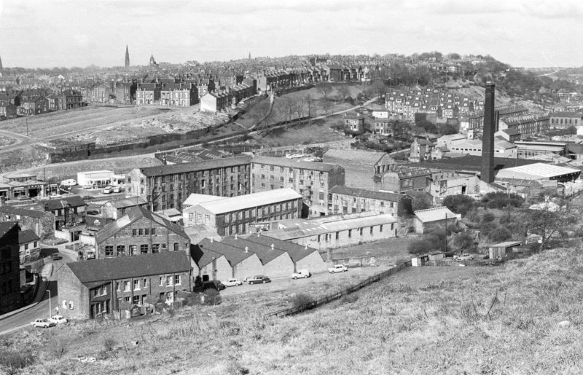
![Woodland Dye Works [demolished], below Grange Court, 1950](https://images.squarespace-cdn.com/content/v1/58c140216b8f5b630c91e446/1552913048768-7IR4VUWNEL1931GUMD1D/7263.jpg)
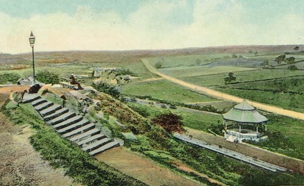
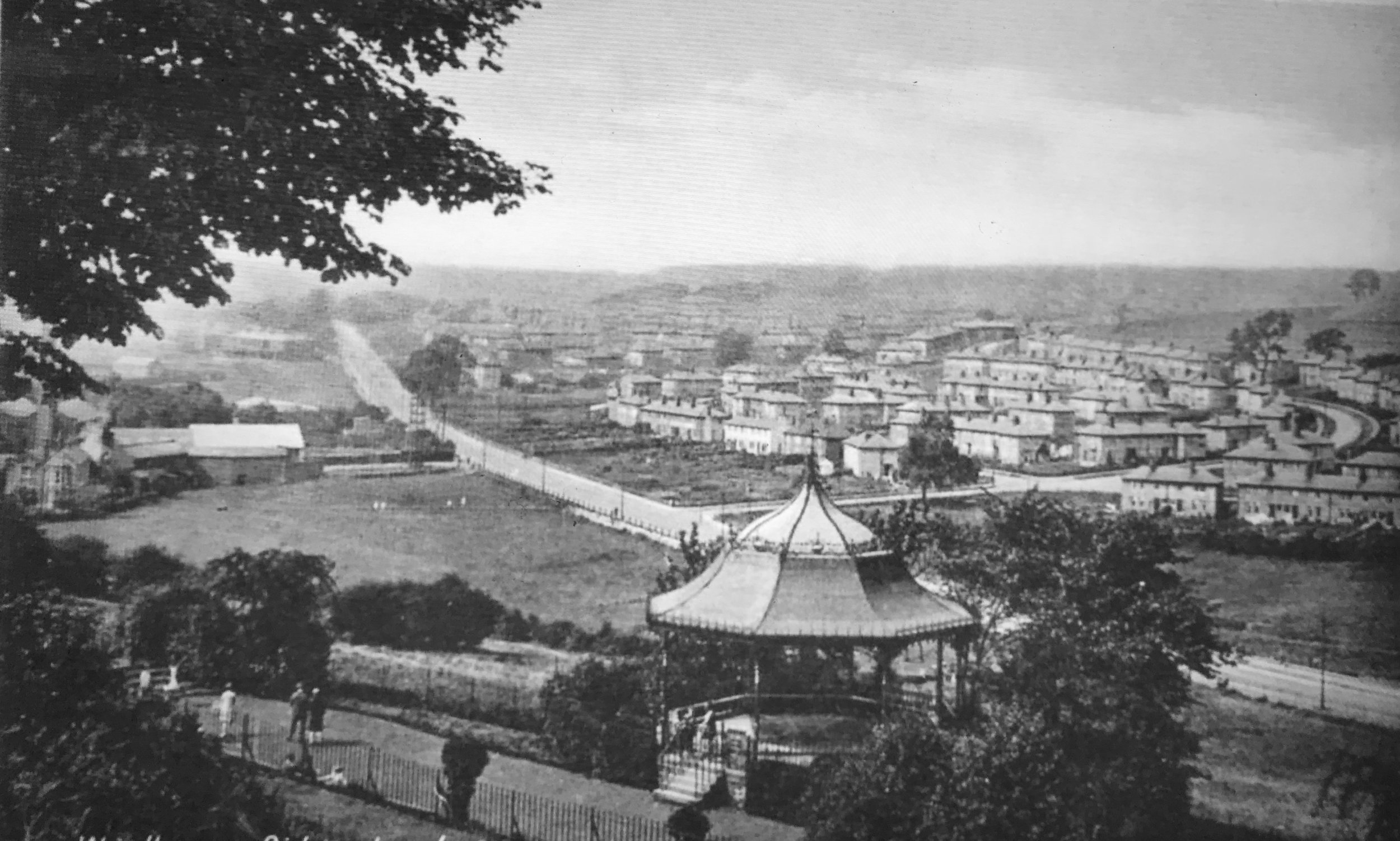
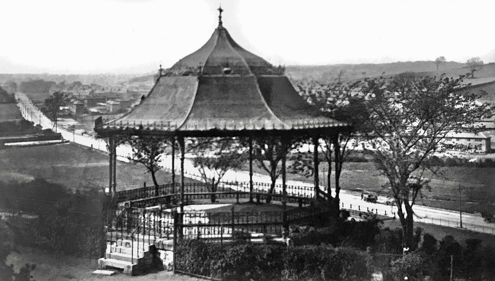
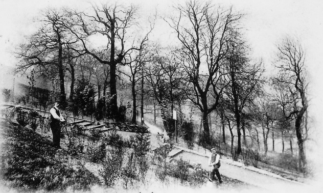
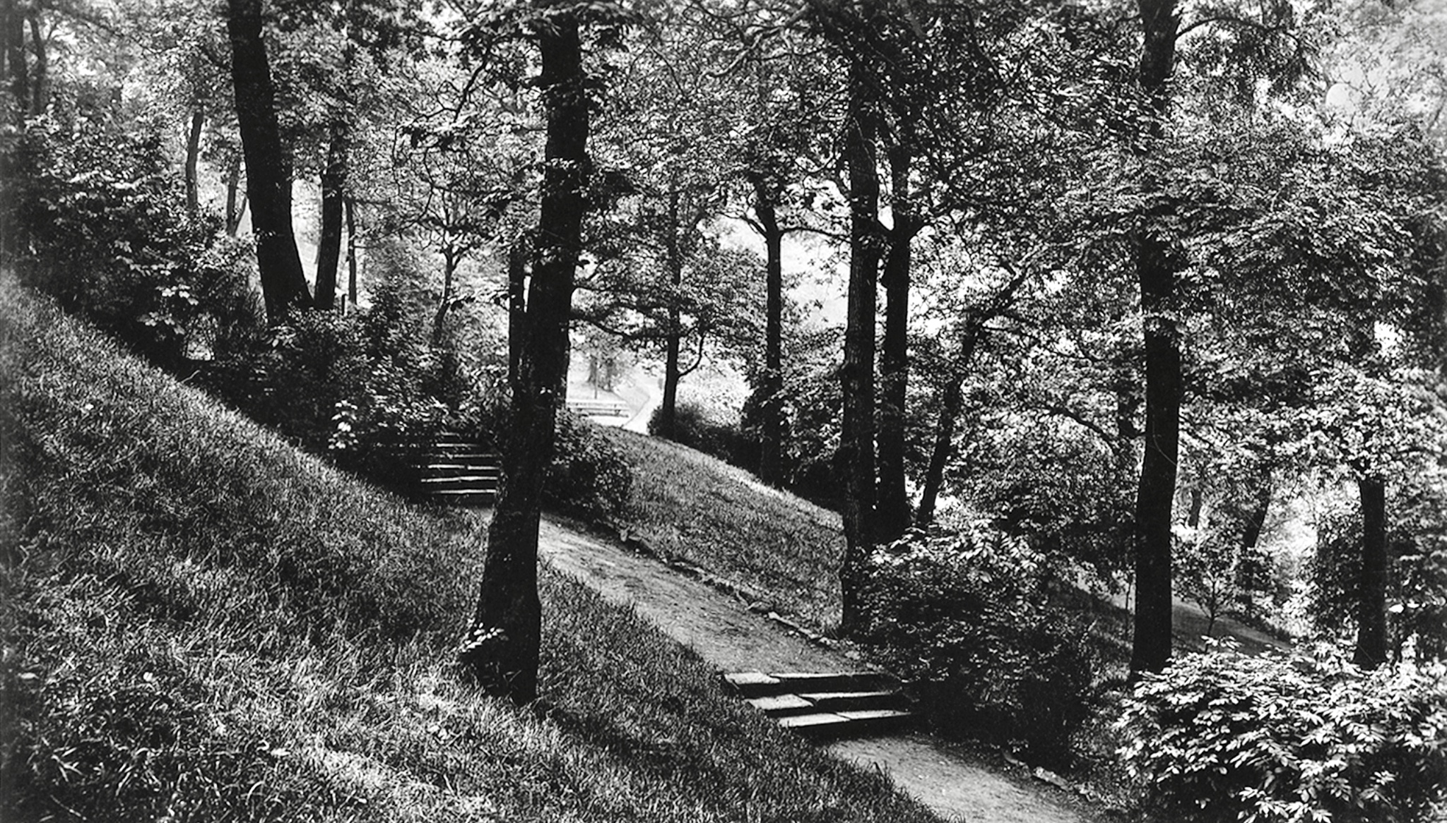
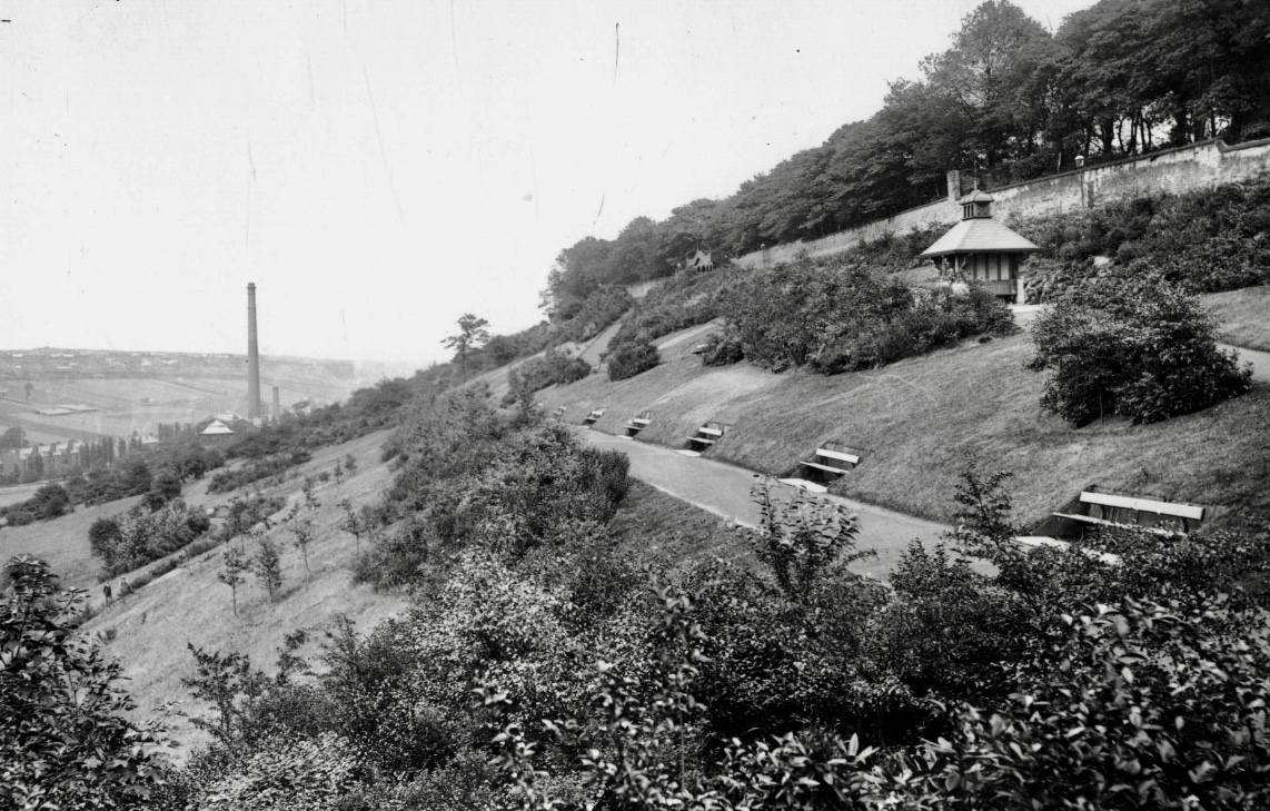
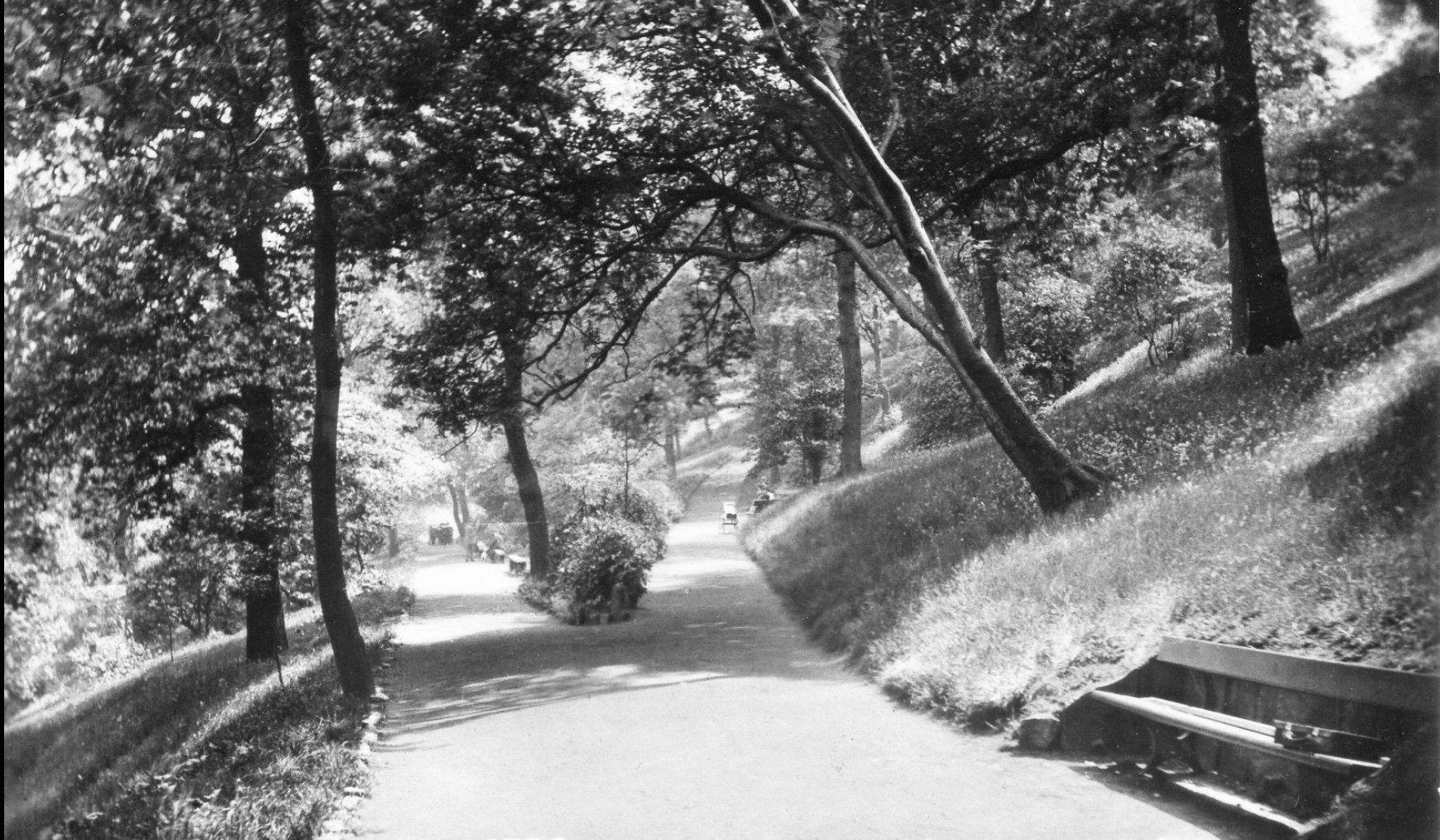
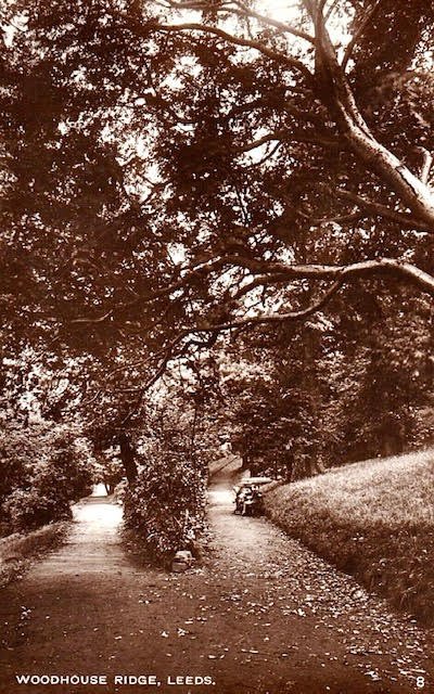
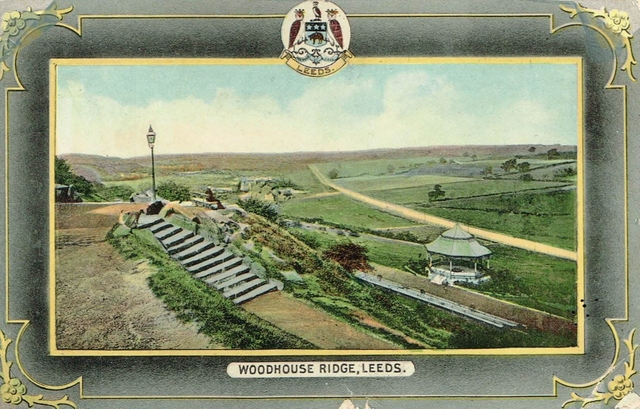
Woodhouse Ridge constitutes the north-east edge of Headingley Hill, dropping steeply down to Meanwood Beck. Like the rest of Headingley, it was once part of the great Kirkstall Abbey estate (then known as ‘Riggeclyf’). The monks began the use of the Beck as the power source for mills, which continued into the last century. The Ridge passed through various hands until it was bought by Leeds in 1876, and developed as a park, with walks, a bandstand and belvederes (view-point shelters). The park was extended in 1901 by the gift of Batty’s Wood by Alderman John Warburton (commemmorated by a Chinese pavilion).
Download WRAG’s Woodhouse Ridge Heritage Trail.
Photographs by kind permission of Leeds Library and Information Service, the Thoresby Society, Leeds Civic Trust, Nigel Lees and Helen Pickering. Some postcards are from the collection of Zoe and Alec Main, long-serving WRAG members and campaigners. The photographs are subject to copyright and should not be reproduced without the owner's permission.
See also, Woodhouse Ridge and History of Headingley.
For historic photos of other parks, go to Parks in the Past.
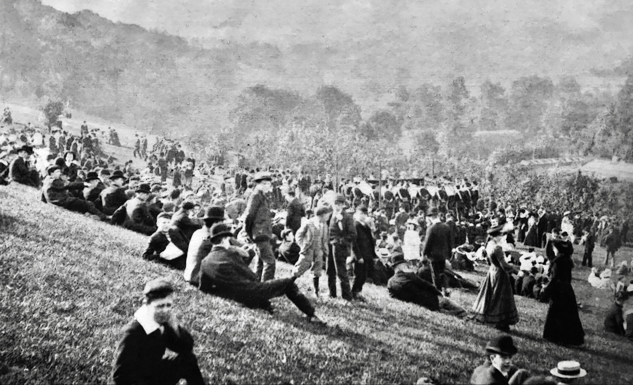
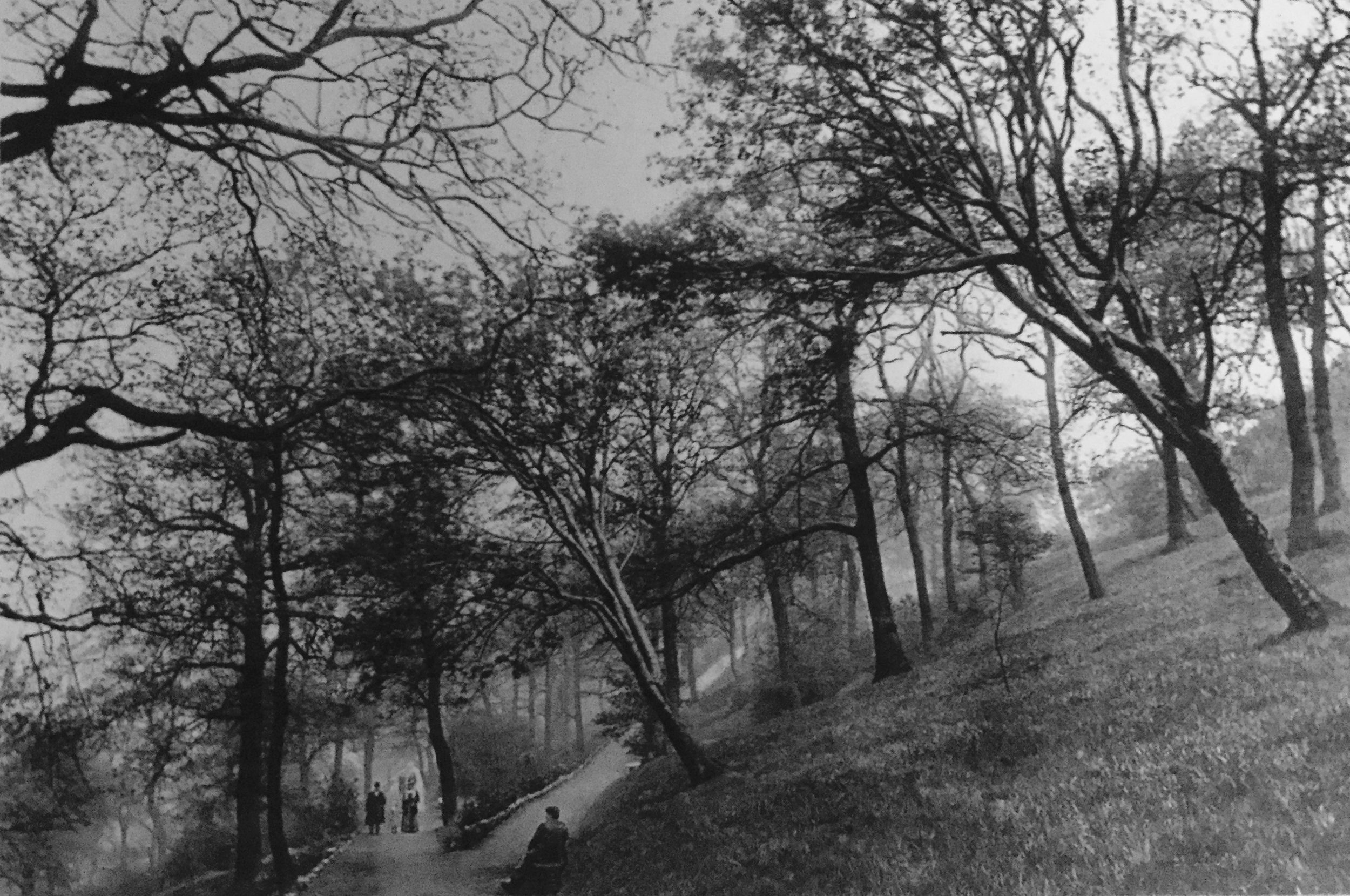
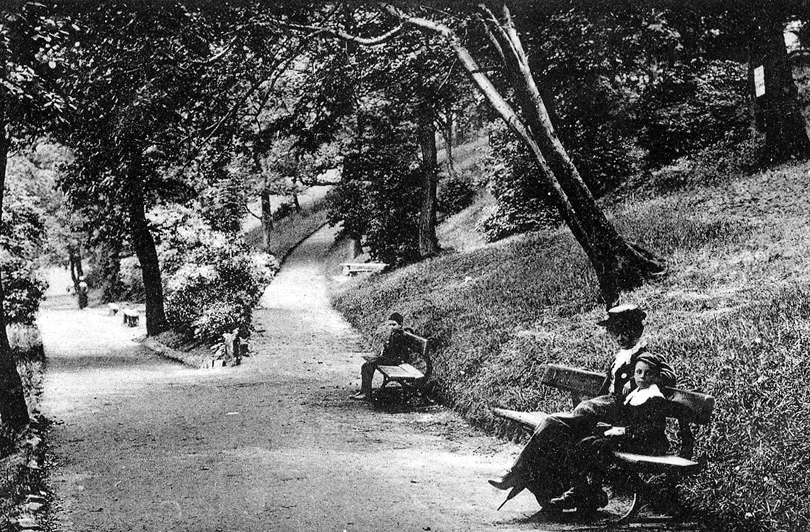
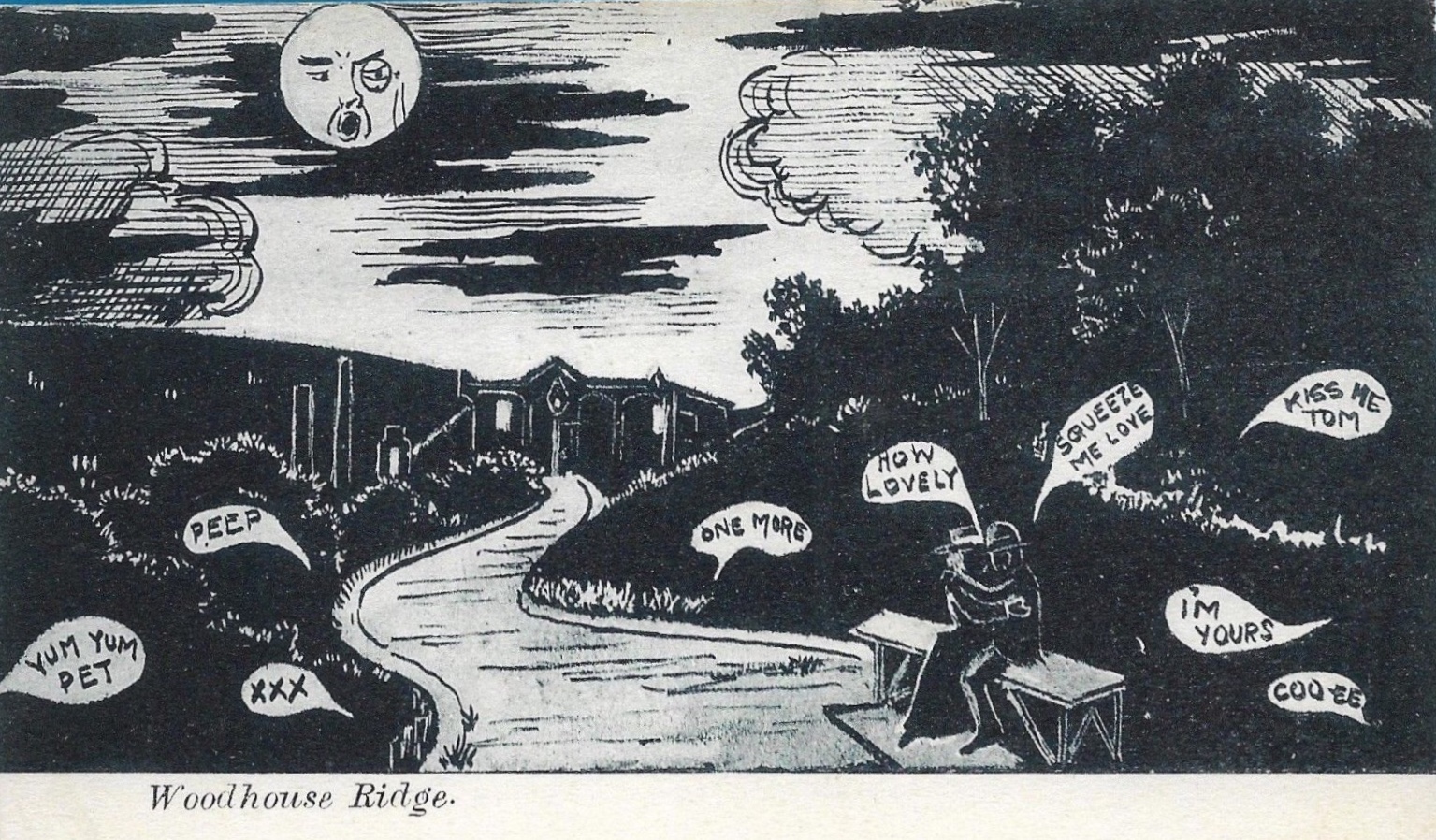
Nigel Lees, Secretary, Woodhouse Ridge Action Group, writes: The large number of postcard images of Woodhouse Ridge is testimony to its great popularity in the early twentieth century and the pride in which it was held. They reveal how changed The Ridge is now from its early years as an open manicured Edwardian parkland, replete with ornamental shelters, manifold benches, drinking fountains and a fine bandstand. The postcard messages also are of their time: "This is a large piece of ground, rising tier upon tier, called the Ridge. It is all among the hills. Love from Dollie" "How would this place do for a nice walk, it's only a mile from town, Joe" "I used to go courting here, many, many years ago" (anon.) And in a pre-Tinder age: "This is one part of the Ridge where it is quiet. Past where the bandstand and most of the people go. Shall be pleased to receive a photo of you in return for the one of myself. Hope to hear from you soon, Winifred"
